What is Drone Mapping?
Drone Mapping in Chattanooga, Tennessee
Drone mapping uses advanced unmanned aerial vehicles (UAVs) equipped with high-resolution cameras and sensors to capture precise data and aerial imagery of specific locations. This information is processed into detailed 2D maps and 3D models that support a wide range of industries—from construction and land development to agriculture, environmental monitoring, and infrastructure inspection.
How Drone Mapping Works
The process begins with drones flying pre-programmed routes over the area of interest. Equipped with RGB, thermal, or multispectral cameras, the UAVs capture thousands of overlapping images. Specialized software then stitches these images together into accurate maps and models, while also analyzing details such as topography, vegetation health, and even soil conditions.
Key Advantages of Drone Mapping
Improved Safety – UAVs can quickly map hazardous or inaccessible areas, such as flood zones, landslide regions, or steep terrain, without putting surveyors at risk.
Efficiency & Cost Savings – Traditional surveying methods are time-consuming and expensive. Drones cover large sites in a fraction of the time and deliver actionable data within hours.
High Accuracy – Advanced mapping technology provides centimeter-level accuracy, making it ideal for engineering, surveying, and planning projects.
Applications of Drone Mapping
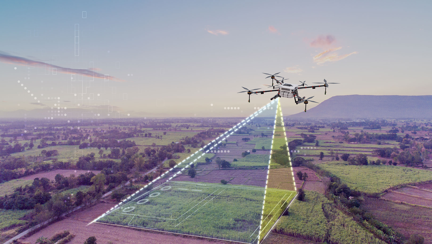
Agriculture
Farmers in Tennessee are using drone mapping to improve crop yields and streamline operations. UAV data helps identify irrigation issues, soil variability, and crop stress, allowing for precision agriculture techniques such as variable rate fertilization and targeted irrigation.
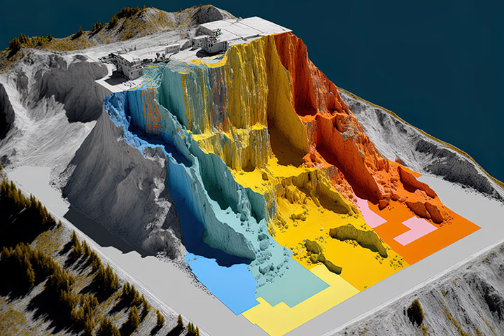
Construction & Development
Drone mapping provides real-time progress reports, volume measurements, and site safety assessments. Contractors and project managers in Chattanooga can use this data to improve workflow, enhance safety, and reduce costly delays.
Environmental Monitoring
From monitoring water quality in rivers and lakes to tracking forest health and erosion patterns, drones provide environmental agencies and organizations with accurate and repeatable data collection methods that traditional ground surveys can’t match.
Drone Mapping in Tennessee
Drone mapping is transforming industries across Chattanooga and the surrounding Tennessee Valley. Businesses and government agencies are turning to UAV technology for faster, safer, and more cost-effective data collection.
At Gig City Drones, we specialize in professional drone mapping services. Whether you need aerial surveys for construction, agriculture, or environmental projects in Chattanooga or anywhere across Tennessee, our FAA-certified drone pilots deliver the high-quality data you need.
Contact Gig City Drones today to request a custom quote for your mapping project.