
Chattanooga Drone Mapping
Welcome to Gig City Drones! Based in Chattanooga, Tennessee, we’re your trusted experts in drone mapping and aerial imaging across Southeast Tennessee and North Georgia. Using the latest drone technology, we transform aerial data into highly detailed 2D orthomosaic maps and 3D models that go far beyond simple photography. These tools provide critical insights that help businesses, construction teams, farmers, and local governments make smarter, data-driven decisions.
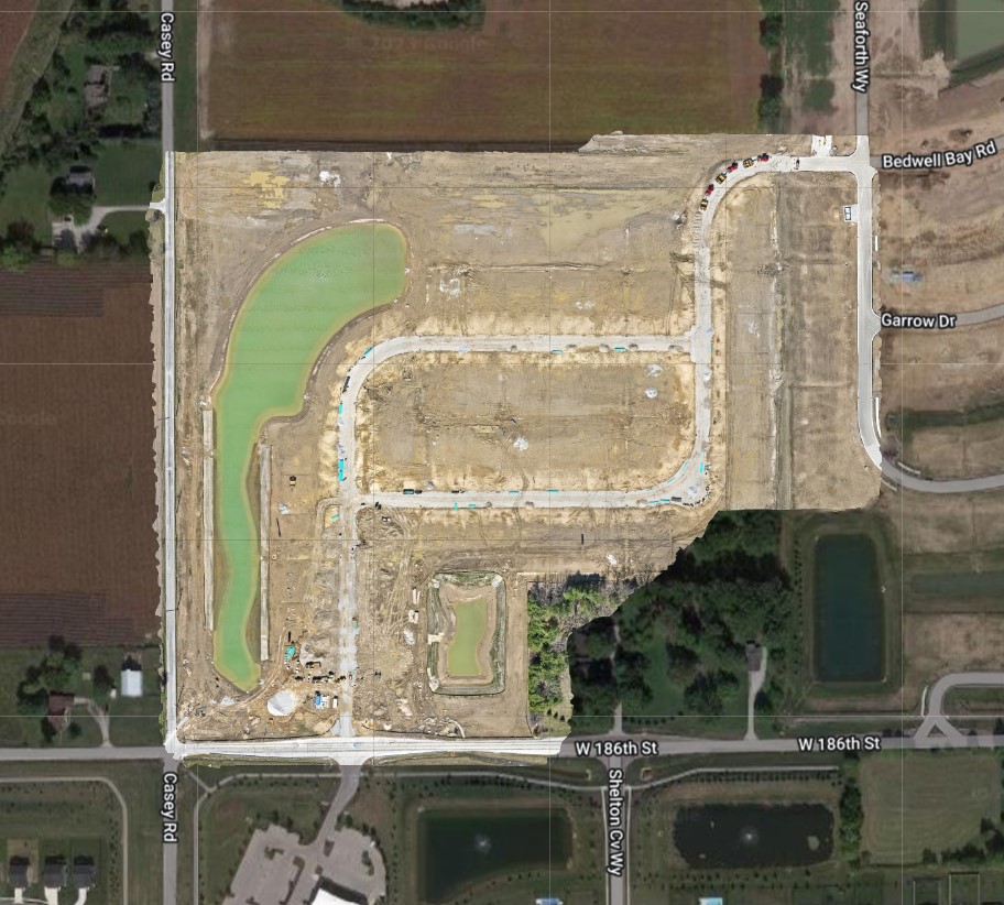
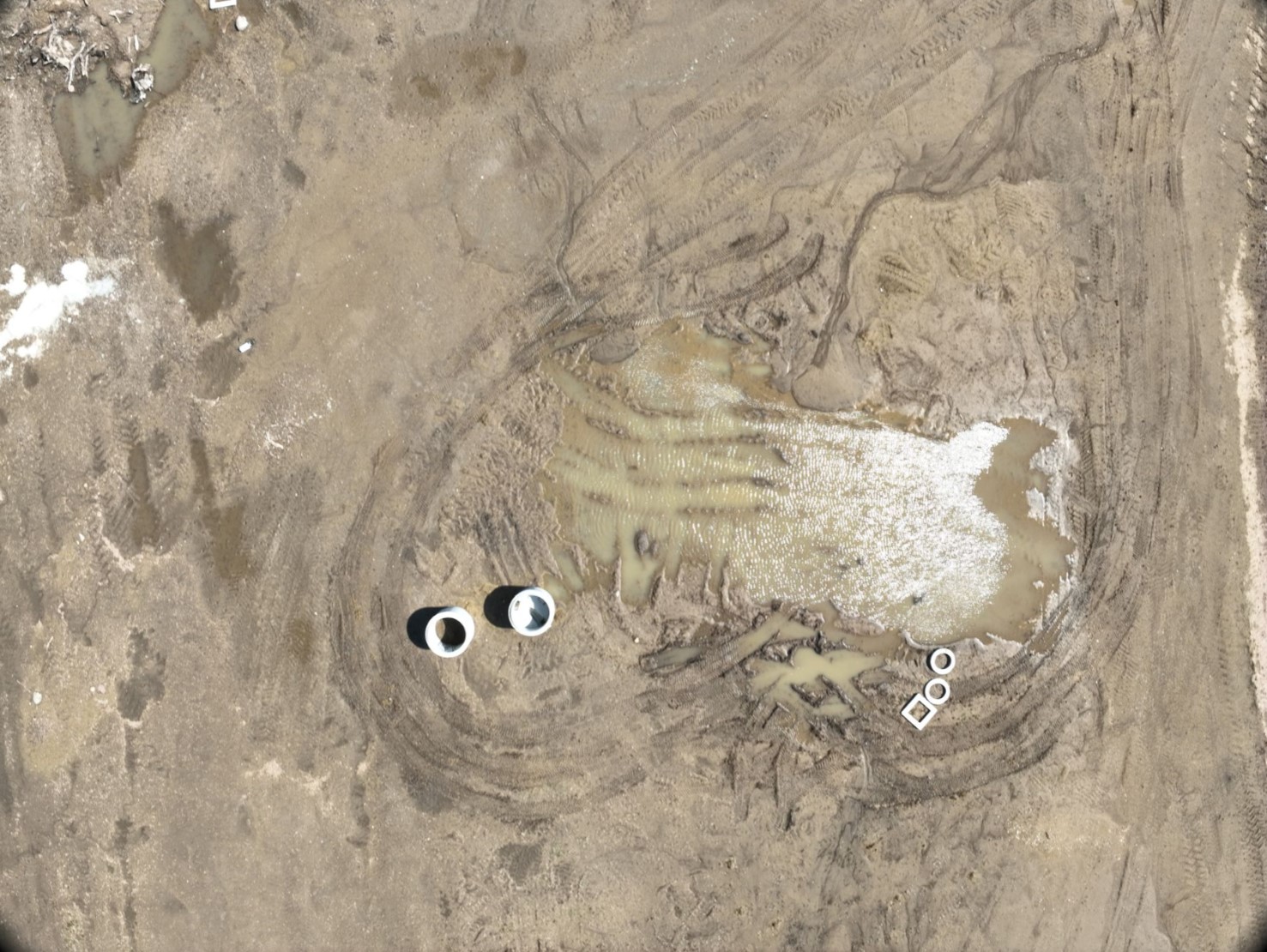
2D Orthomosaic Maps – Precision from Above
Crystal-Clear Views – Our orthomosaic maps are like a seamless puzzle of aerial photos, stitched together into one accurate, high-resolution map.
Built for Accuracy – Loaded with precise measurements, scale, and coordinates, these maps are invaluable for industries such as construction, land development, agriculture, and real estate.
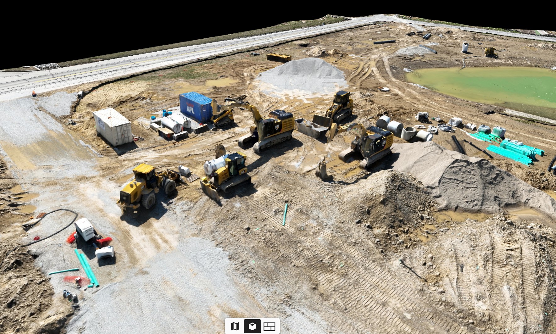
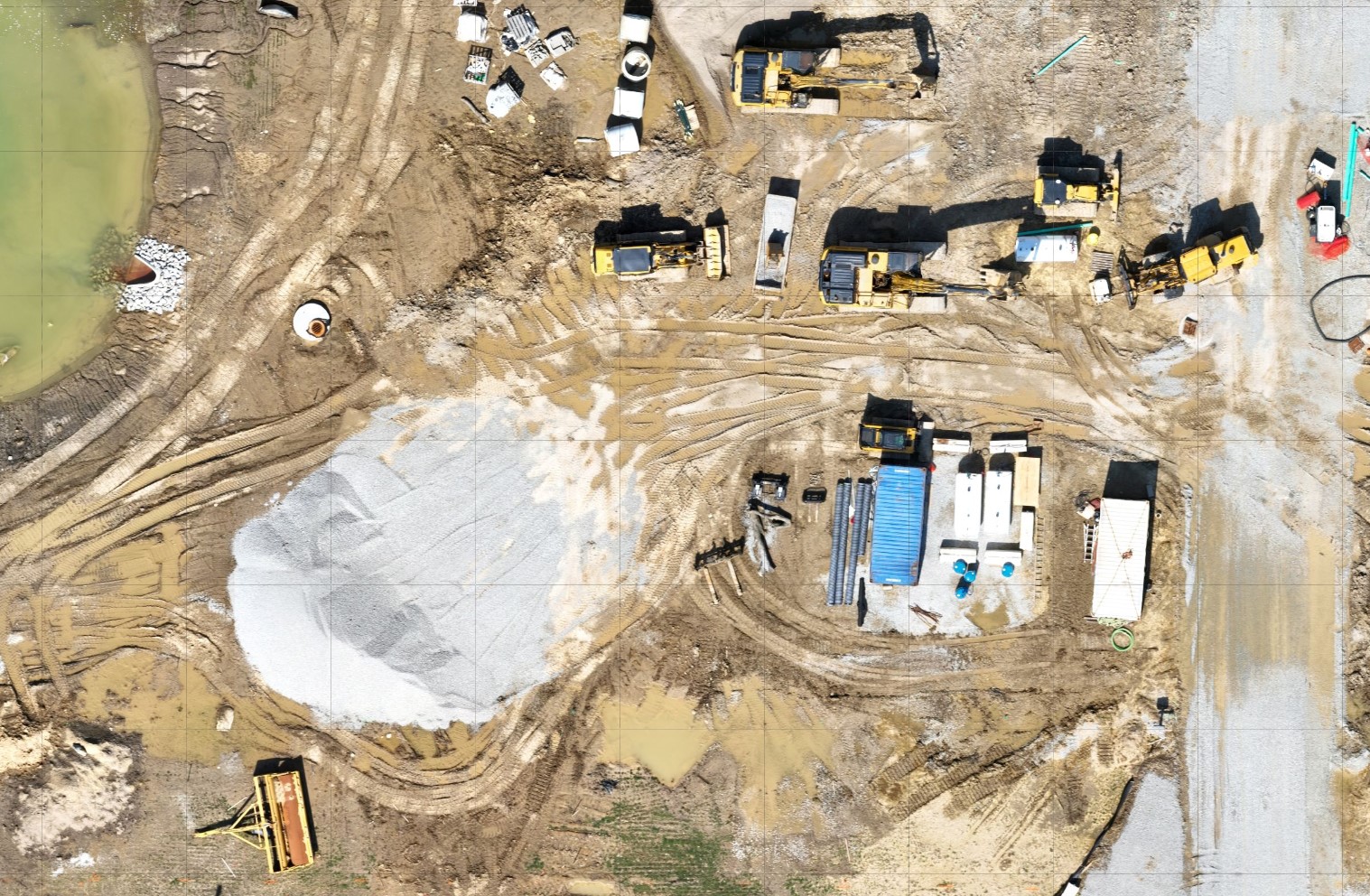
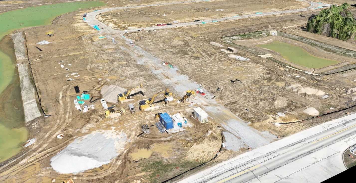
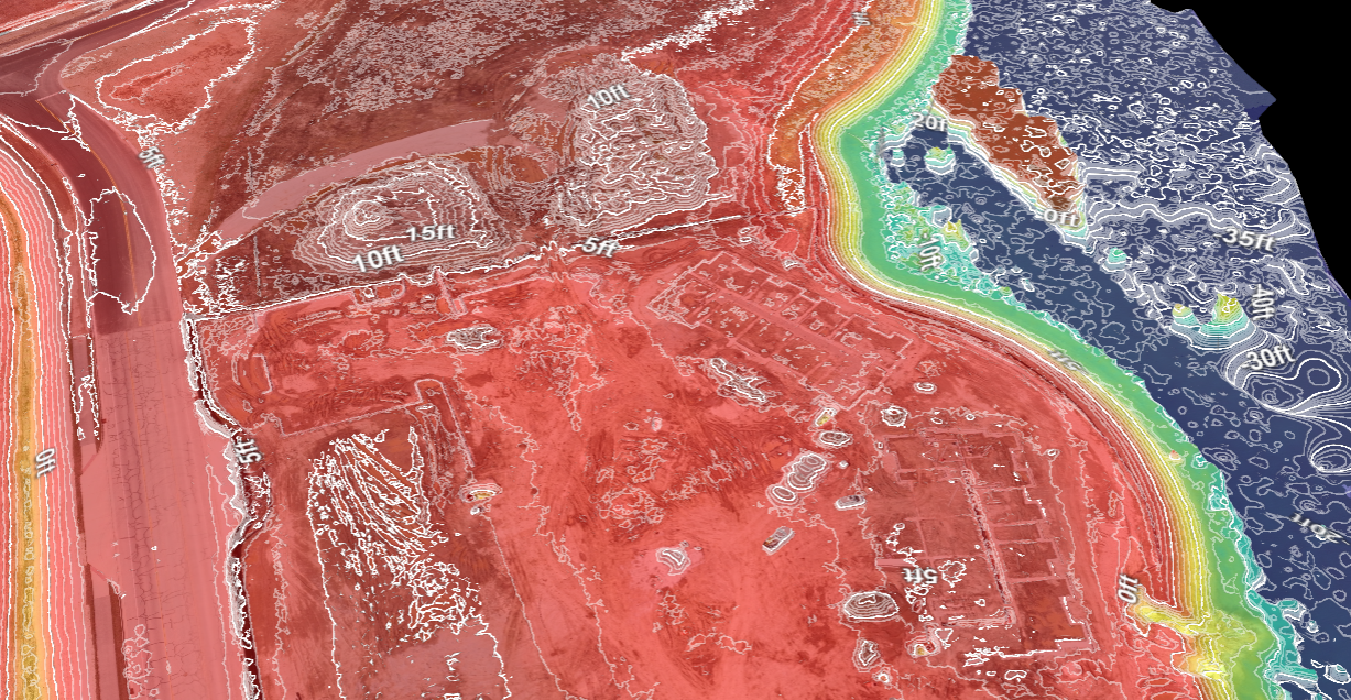
3D Modeling – Your Project in Full Dimension
More Than Flat Maps – Our 3D drone models provide a true-to-life view of terrain, buildings, and infrastructure—ideal for planning, surveying, and development.
Real-World Applications – From analyzing construction sites to identifying land risks, 3D modeling offers unmatched clarity and perspective.
Why Choose Drone Mapping from Gig City Drones?
Construction Safety & Efficiency – Identify hazards, track progress, and streamline project management with detailed aerial maps.
Smarter Agriculture – Monitor crop health, detect problem areas early, and reduce chemical use with precision farming insights.
Urban & Land Planning – Visualize developments, evaluate environmental impact, and simplify stakeholder presentations with accurate drone data.
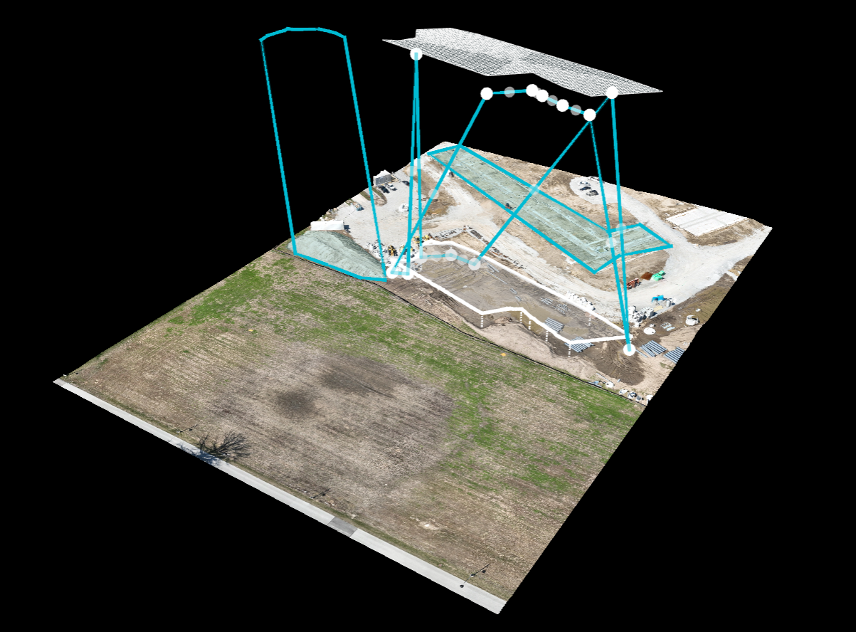
Powered by DroneDeploy Technology
We use DroneDeploy, one of the most advanced mapping platforms available, to deliver professional, easy-to-use data. From generating orthomosaics to creating 3D models, DroneDeploy ensures your aerial data is accurate, accessible, and actionable.
Why Gig City Drones is the Smart Choice
Certified & Insured Pilots – Every flight is conducted by an FAA Part 107 certified and insured drone operator.
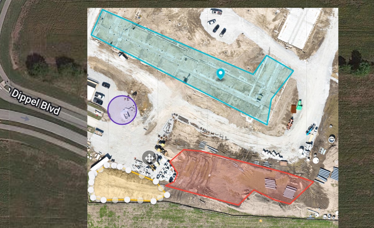
Accessible Data, Anytime – View, download, and measure from your maps whenever you need them—whether for reporting, planning, or presentations.
Industry Versatility – From farmers to builders to municipalities, our mapping services bring clarity and efficiency to every project.
Discover the Power of Drone Mapping
At Gig City Drones, we combine technology, expertise, and creativity to provide mapping solutions that save time, reduce costs, and improve decision-making.
📩 Curious about how drone mapping in Chattanooga and North Georgia can help your project? Contact Gig City Drones today for a free quote or consultation—we’re ready to help you see the bigger picture from above!