Drone Mapping Tips & Training: Fly Smarter with Gig City Drones
At Gig City Drones, we don’t just provide professional drone mapping services—we also love helping new drone pilots learn how to master aerial mapping. Whether you’re exploring drone mapping for surveying, construction, agriculture, or real estate, these tips will set you up for success. And if you’d like more hands-on education—or even want to shadow us on a real job—reach out. We’re always excited to support Chattanooga’s next generation of drone pilots.
So, strap in and let’s dive into some practical best practices for capturing high-quality aerial mapping data.
1. Plan Your Mission Like a Pro
Before takeoff, thorough planning is everything. Scout the area you’ll be mapping, check for no-fly zones, and consider weather conditions. Use mapping software (like DroneDeploy or Pix4D) to pre-set flight paths, waypoints, and altitude. This ensures consistent coverage and helps you maximize efficiency.
2. Pick the Right Drone & Camera Setup
The gear you choose makes a big difference in mapping quality. Look for drones with:
Long flight time (so you can cover larger areas)
Stable gimbals for smooth image capture
High-resolution cameras for sharp details
Wide-angle lenses to cover more in each frame
At Gig City Drones, we often rely on enterprise-level drones like the DJI Mavic 3 Enterprise, which offers superb flight endurance and imaging performance.
3. Optimize Your Camera Settings
To capture crisp, detailed images, adjust your camera wisely:
Shoot in RAW/DNG for flexibility in post-processing
Balance ISO, shutter speed, and aperture to match lighting
Avoid auto settings when possible for more consistent results
Don’t be afraid to experiment until you find the sweet spot between image quality and efficiency.
4. GPS + Overlap = Mapping Accuracy
For seamless map stitching, two things are essential:
GPS Positioning: Ensures precise geo-tagging of every shot
Image Overlap: Aim for 60–80% overlap between images
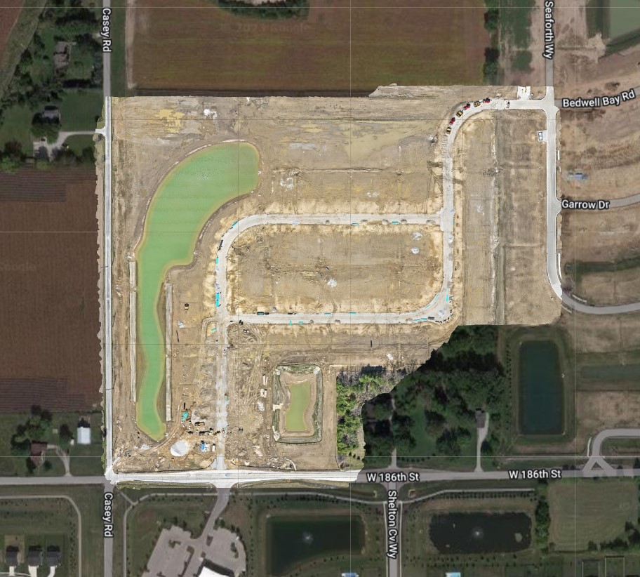
This combo gives you reliable, detailed orthomosaics and 3D models.
5. Fly in the Right Conditions
Clear skies, low winds, and consistent lighting make all the difference. Avoid shooting in harsh weather or during times of day when shadows distort the terrain (early morning or late evening). Midday flights, when the sun is high, typically deliver the most consistent results.
6. Master Your Flight Technique
Smooth, steady flying leads to sharper images. Keep a consistent altitude and speed throughout your mission. Use automated flight modes—like waypoint navigation—for more complex mapping jobs. The more you practice, the more natural it becomes.
7. Post-Processing = Professional Results
Once your flight is complete, the real magic happens. Use mapping software to:
Stitch images into orthomosaics or 3D models
Correct lens distortion
Adjust exposure, colors, and contrast
Reduce noise and sharpen details
This transforms raw data into polished, professional maps that clients can use for decision-making.
Safety First
At Gig City Drones, safety is always our top priority. Stay updated on FAA regulations, perform routine maintenance on your gear, and double-check equipment before every flight. A safe pilot is a successful pilot.
Learn, Train & Grow with Gig City Drones
Once you’ve built confidence in your mapping skills, who knows—you may even get the chance to work alongside us on commercial drone mapping projects here in Chattanooga.
Whether you’re looking for professional drone mapping services or training to sharpen your piloting skills, Gig City Drones has the expertise and technology to help.
📞 Contact Gig City Drones today to learn more, schedule training, or book a mapping project.
Happy flying—and happy mapping! 🚁

